 Geosur
Climatology, meteorology, atmosphere
Type of resources
Available actions
Topics
INSPIRE themes
Keywords
Contact for the resource
Provided by
Years
Formats
Representation types
Update frequencies
status
Scale
-
Since 2012, 3 lidars from the Atmospheric Physics Observatory of La Réunion (OPAR) have been performing aerosol profile measurements at the Maïdo observatory site, located at 2160 meters to the west of the island of La Réunion. These profiles are obtained at several wavelengths, 355nm and 532nm, and there are also depolarized channels at 532nm. The data from these 3 lidars are processed in two stages: initially, the data are manually cleaned of disturbed profiles, either by atmospheric effects, such as the passage of clouds, or by electronic effects like noise. They are then summed over the night. This is the L1b level, and the data are available in the Matlab format (.mat). Subsequently, the data are processed to convert from a profile of received photon number to a profile of aerosol extinction and scattering. The methodology used is based on the Klett calculation at one wavelength. This is the L2b level, and the data are available in the NetCDF format (.nc) with the NDACC convention in the choice of variable names. Therefore, the data are distributed across 6 directories, 2 levels of processing for each lidar. The raw data from the instrument (called L0) are in a proprietary format, the Licel format, and are not accessible in open access, only via FTP with restricted access.
-

Meteo station Vantage Pro 2 Recorded parameters: - Wind speed and direction - Pluviometer - Temperature - Humidity (inside shelter) and outside - Barometric pressure Data transmission towards station of acquisition via WiFi. This station is connected on a PC Windows software.
-
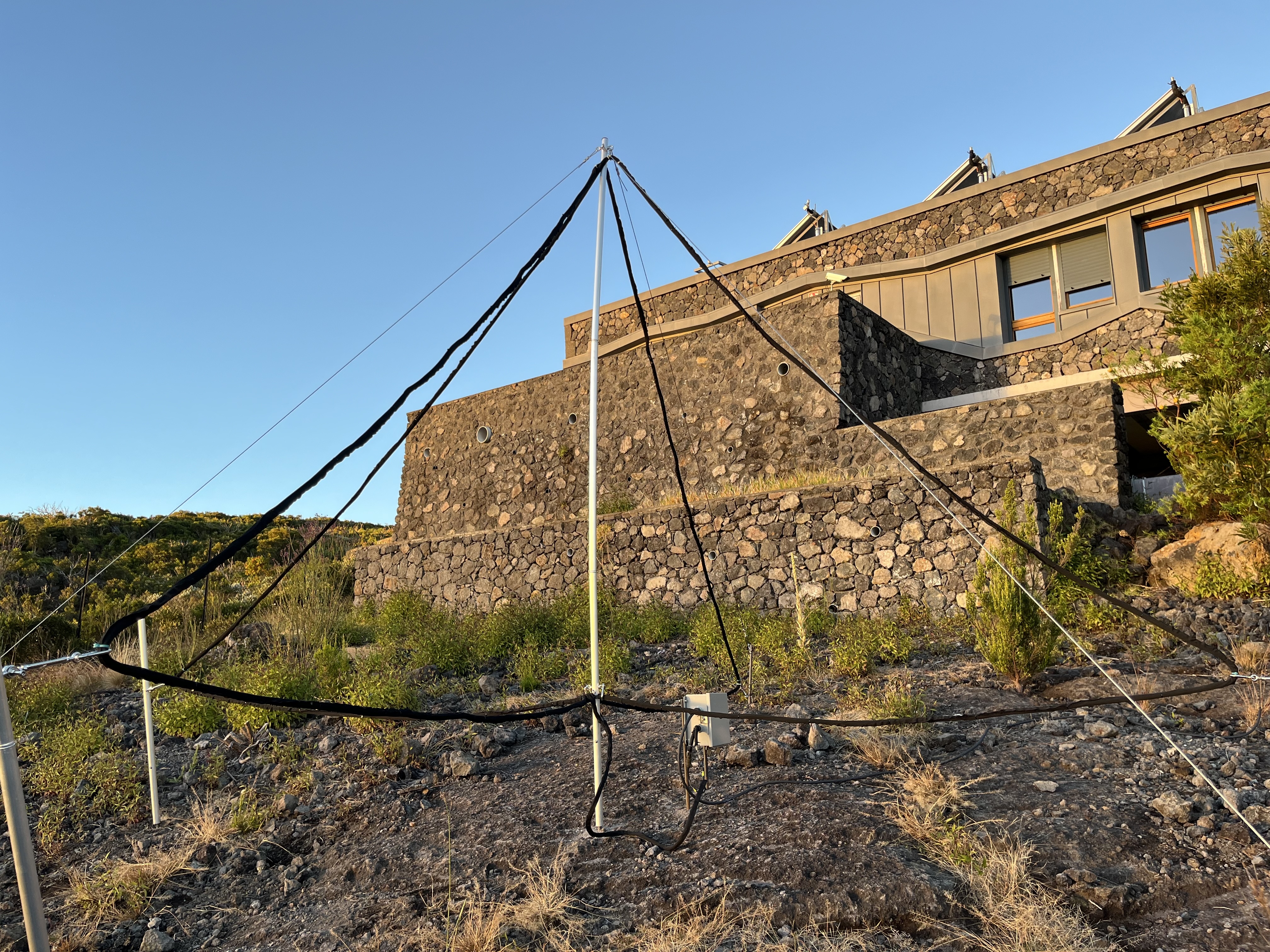
Les ondes VLF émisent par des transmetteurs sur Terre, se propagent dans le guide d'onde formé par l'ionosphère et la Terre. En cas de changement de conductivité des limites de ce guide d'onde, les signaux reçus sont modifiés. C'est ce qu'il peut arriver par un forçage d'origine solaire (éruptions) ou liés à des zones orageuses (TLE). L'analyse de ces signaux en amplitude et phase permet de remonter à la perturbation de la densité électronique. Celle-ci induit notamment une augmentation de l'absorption HF. Outre les études sur la réponse de l'ionosphère à un forçcage (solaire ou TLE), le projet a une dimension sociétal en fournissant des alertes temps réel sur l'occurrence d'une éruption solaire. L'instrument est composé de deux "boucles" (plutôt des triangles) magnétiques orientées NS et EW. La base de l'antenne mesure 4.57m, la hauteur 2.80m, soit une surface totale de 5.22m2. Avec 11 tours de fil de cuivre on obtient une sensibilité de 3.57E-13 T/rt-Hz; Les "boucles" sont connectées à un pré-ampli situé au pied du mât. Ce pré-amp contient également le système de calibration. Un câble apportant l'électricité et ramenant les signaux part du pré-amp, courre dans les chemins de câble et arrive au "line Receiver", un boite électronique jaune située près du PC de contrôle. Cette électronique contient un ADC et reçoit le timing du GPS. L'ensemble des signaux est ensuite conduit vers le PC de contrôle qui effectue la démodulation des signaux MSK (méthode de transmission des données VLF) et produit les données NarrowBand et BroadBand. L'instrument fonctionne en continue 24/365. Le PC redémarre seul en cas de coupure d'électricité. Pour vérifier que l'instrument est bien en fonctionnement, il suffit de regarder la date et l'heure du spectrogramme affiché (rafraichissement toutes les minutes).
-
The ressource describes the dataset obtained by deploying the GAMIC GMWR-25-DP RADAR in the South of Reunion Island, in Saint Joseph.
-

The station is managed by the Observatoire de la Zone Critique de la Réunion (OZC-R) from Observatoire des Sciences de l'Univers de La Réunion (OSU-Réunion, Université de La Réunion). This is a forest station located at 1285m asl in the Reunion National Park. Rainwater is monthly collected (PALMEX rain collector) for δ18O and δ2H water isotopes analysis from 2016. Analyses are carried out at the Institut de Physique du Globe in Paris (PARI analytical platform) and within the IR-OZCAR network. The major ions rainfall composition is also studied. The station also measures several meteorological variables outside the canopy (precipitation, atmospheric pressure, temperature, relative humidity, global and photosynthetically active radiation) but also humidity linked to clouds and fog, as well as ground temperature.
-
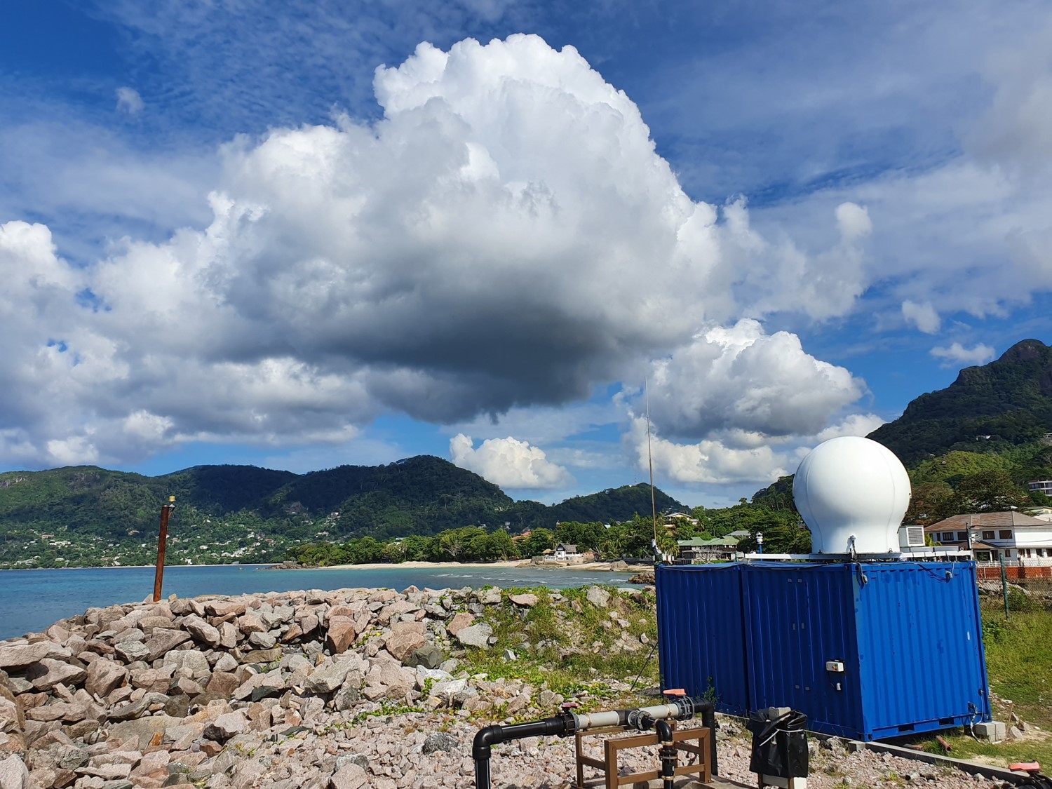
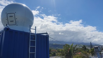
The ressource describes the dataset obtained by deploying the GAMIC GMWR-25-DP RADAR in the north of Mahé Island, in Seychelles.
-
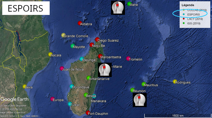
This ressource is part of the action 1 of the ESPOIRS Project. Multiple GNSS Stations have been installed or updated in the SWIO and the data are available here. "TO ADD : Different datasets, list of stations, etc ...."
-
The station is managed by the Observatoire de la Zone Critique de la Réunion (OZC-R) from Observatoire des Sciences de l'Univers de La Réunion (OSU-Réunion, Université de La Réunion), and located at 80m asl at the Reunion University. Rainwater is monthly collected (PALMEX rain collector) for δ18O and δ2H water isotopes analysis from 2001. Analyses are carried out at the International Atomic Energy Agency as part of the global network for measuring isotopes in precipitation (GNIP-IAEA).
-

The overall objective of the ESPOIRS project is to obtain a better understanding of the variability, statistical properties and formation mechanisms of intense tropical precipitation at regional and local scales. ESPOIRS is thus interested in the entire life cycle of precipitation at several space-time scales. * Through the analysis of the distribution of the large-scale humidity field which drives the formation of precipitation at the regional scale using a GNSS network. * Through the characterization of internal (dynamics, microphysics) and external (interactions with the relief) processes, which drive the formation and life cycle of extreme weather events at the local scale => transportable Polarized Doppler X-band precipitation radar.
-
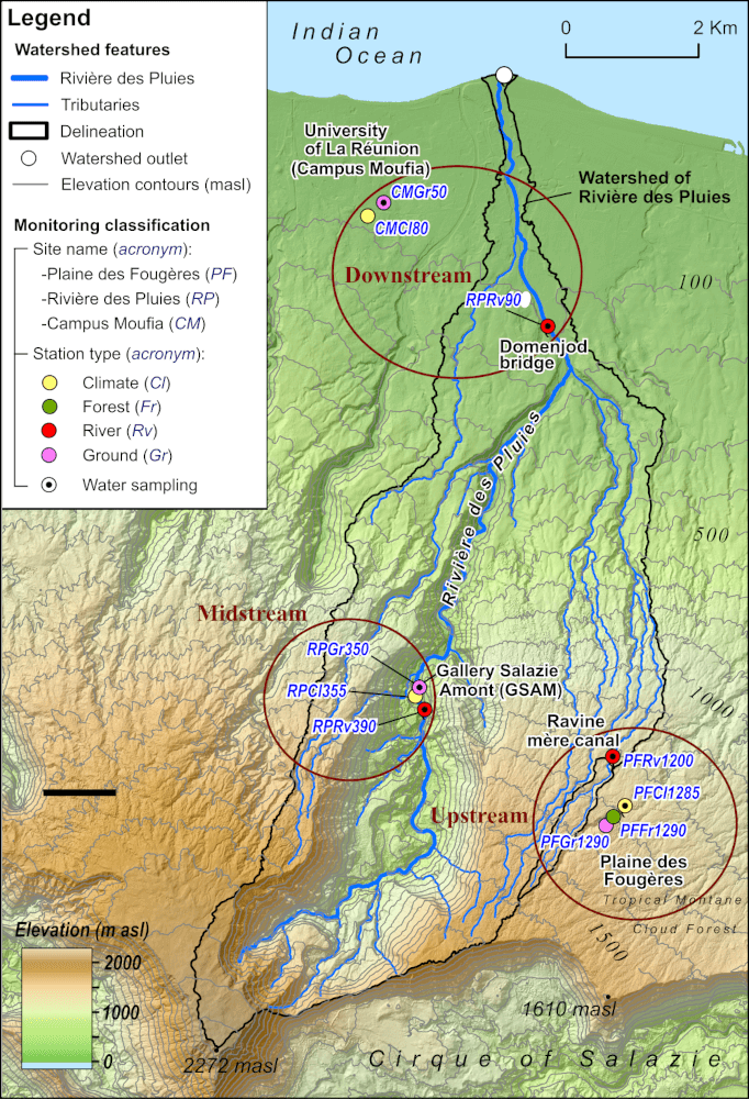
Le projet a pour objectif d'améliorer le signal de la pluie détectée par les géophones en comparant les données météorologiques d'un disdromètre, d'un pluviomètre et de 3 géophones afin d'extraire des données des sismographes pour mieux comprendre le transport sédimentaire issu du réseau sismologique installé dans la rivière des pluies et la rivière du Mat. Les objectifs sont : 1) déterminer les caractéristiques sismiques de la pluie sur le site de mesures 2) A terme, comprendre le déclenchement des éboulements et glissements liés aux pluies A court terme, ce projet devrait aussi permettre de : 1) comprendre pour un même type de pluie l'influence de sols de rugosités différentes sur les signaux enregistrés par les sismomètres 2) intégrer/contraindre pour un même type de sol l'influence de types de pluies différentes sur les enregistrements des sismomètres 3) déterminuer l'influence des tailles des gouttes et du nombre de gouttes (indications données par le disdromètre) sur le signal sismique